https://decolonialatlas.files.wordpress.com/2017/04/watershedseurope1.jpg
Per ampliar les imatges accediu a l'enllaç...
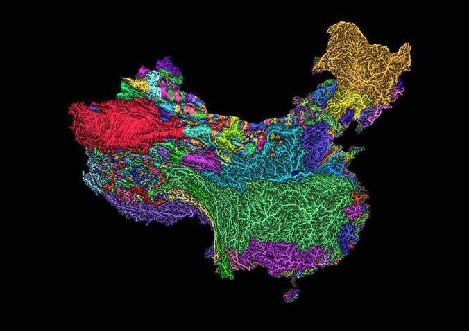
Colorful River Basin Maps
THE DECOLONIAL ATLAS 18/4/2017
Maps as art: The veins of Africa, Australia, Europe, South America, China, India, Mexico the United States, and California. Rivers and river basins visualized by Hungarian geographer Robert Szucs.
“Rivers are amazing. I worked a lot with spatial data during my studies in geography and GIS, and you just see what nature can draw is incredible. Still, all the river maps you see look the same, boring, unspectacular. All lines blue, all the same width. It’s quite amazing how you can make such bad maps from such great source material.”


.jpg)


Cap comentari:
Publica un comentari a l'entrada